
Rail, Road and Corridor Mapping
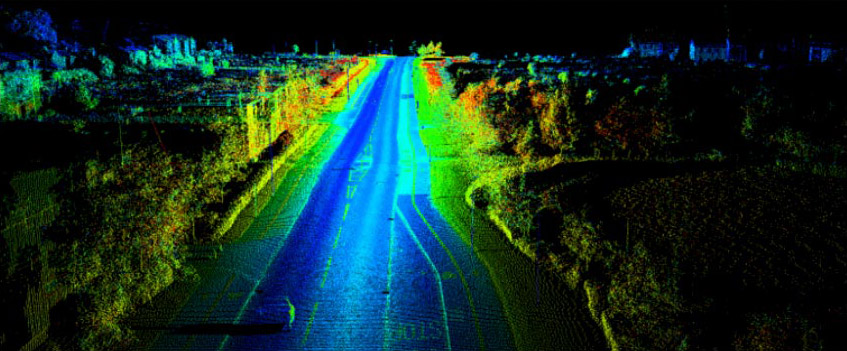
Mobile Mapping is the process of capturing geospatial data from a mobile platform. The ability to collect data at the speed of traffic in a safe environment makes data registration of objects along roads extremely efficient.
Gulf Positioning Services deploy the Trimble MX2 Mobile Mapping System to collect point cloud data and imagery of route corridors such as highway networks,railway systems and urban areas for Dubai and neighbouring countries.
Services
- 3D Inventory Mapping
- 3D Road Mapping
- 3D Pavement Scanning
- Corridor Mapping
- GIS Integration
- 3D City Scanning & Modelling
- 3D Rail Mapping
- Tunnel Mapping (TX8)
- BIM
Download Brochure

November 2017
Accessories Catalog
News
View All-
Feb 27,2017
Gulf Positioning Services is a specialized service provider of 3D Scanning, Mobile…
-
Jan 04,2017
Look at 2017 from a new perspective
Service & Support